Showing posts with label Big Bend Region. Show all posts

Saturday, December 16, 2006

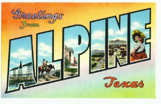
Alpine: Hub of the Big Bend region


If highways are spokes connecting the rim of destinations in the Big Bend Region of West Texas, then Alpine is the hub of the wheel.

From Del Rio, two hundred miles of great highway take travelers to Alpine. And from there travelers can easily travel south to Big Bend National Park (80 miles), north to Fort Davis (26 miles), west to Marfa (26 miles), or east to Marathon (31 miles). But its geography may not be the chief asset of Alpine.

Now, with a population hovering at 6,500, Alpine is growing, but no one seems interested in too much growth and a loss of small town, friendly identity. Still, according to the Handbook of Texas, “Alpine is listed as one of the fifty safest and most economical places for retirement in the United States.”

Climate plays a big role in Alpine’s popularity, aptly named for the cooler temperatures there at 4,481 feet above mean sea level. (Del Rio International Airport is 1,002 feet above MSL.) “We have more than 400 motel and hotel rooms,” Austin enthused, adding that the lodging accommodations range from modern to historic.

Read the full story from swtexaslive.com

Read the Handbook of Texas Online Article on Alpine

Wednesday, August 09, 2006

Palo Duro Canyon - an Awesome Place

Palo Duro Canyon is one awesome hole on the ground

Leon Hale visits Palo Duro Canyon.

PALO DURO CANYON — My guess is that a great many Texans don't know that this great hole in the ground exists.

My guess is that he's right.

Read the article from today's Houston Chronicle.

Visit Leon Hale's blog at: http://blogs.chron.com/leonhale

Tuesday, August 01, 2006

History of Fort Davis & the Davis Mountians

They used to be the Apache Mountains...

A Look at the History of the Davis Mountains from mywesttexas.com, part of a continuing series about the "Triangle" area of Alpine, Fort Davis and Marfa

They were not called the Davis Mountains until after Fort Davis was established in 1854. They were the Apache Mountains then because that's who owned them.

War chiefs Victorio, Juh, Mangas Coloradas, Nicolas and Nana roamed them and enough Comanches were raiding Mexico for this part of deep West Texas to be on Great Comanche Trail.

To put it in modern terms, conditions were unfavorable for economic development. Built on 500 acres in a box canyon near Limpia Creek, soldiers were needed to protect stagecoaches, wagon trains, railroad surveyors and eventually settlers.
Read the full article from mywesttexas.com
Photograph of Mitre Peak near Ft. Davis from Texas Old Photos